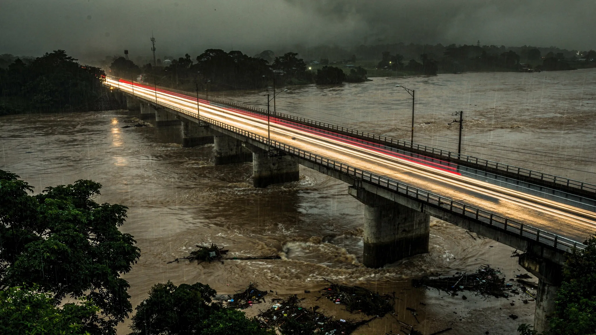
A HUMMING BRIDGE X-RAYED A RIVERBANK DURING A FLOOD
Rivers and roads often share the same corridor. Under the bridges, deep foundations reach tens of metres into soft river sediments, where water moves back and forth between the river and the groundwater. During extreme floods, two threats combine: the current can scour soil away from the foundations, and rising water pressure in the ground weakens the riverbanks. Yet monitoring still relies on a few point sensors, isolated wells and occasional manual surveys.
The noise gap along highways
Seismologists can image the ground with surface waves, and even track tiny changes in their speed over time. To probe tens of metres down, though, they need low-frequency waves. Along highways, the paper notes, there is a gap: ocean-generated vibrations sit below 1 hertz and probe too deep, while passing vehicles mostly shake the ground above 6 hertz and probe too shallow. Moving traffic is also a poor source for repeated measurements, because it never comes from the same place twice.
Distributed acoustic sensing solves the sensor problem. Connected to an instrument called an interrogator, an existing telecom fibre becomes thousands of seismic sensors a few metres apart. The missing piece was a good, steady source.
The bridge as a loudspeaker
Haipeng Li and colleagues at Stanford University, with a partner at Nanyang Technological University in Singapore, used an unused (“dark”) telecom fibre along South Korea’s Gyeongbu Expressway, near Cheongju. On the 430-metre concrete bridge over the Miho River, the cable is clamped to the outside of the deck; on either side, it runs underground along the approach embankments. They recorded from 15 to 25 July 2025.
Each car and truck strikes the deck, which rings at its own frequencies. On the bridge, the fibre picks up a comb of tones at 2.6, 2.8, 3.1, 3.4, 3.9, 4.3 and 4.6 hertz — 20.5 decibels above the roadside background. The piers and abutments push those vibrations into the soil, where they travel as surface waves across both riverbanks for more than 400 metres.
The bridge acts as a mechanical filter: random axle impacts go in, a steady hum comes out. Because a vehicle crosses roughly every second, faster than the vibrations die away, the hum never stops. Traffic changes its loudness by 2.7 decibels between day and night, but barely its pitch, and even at the height of the flood the deck lost only 1.2 decibels of power.
Five minutes for a clean picture
Using a technique called seismic interferometry, the team turned the recordings into “virtual shots”, as if a source had been fired at chosen points. With the bridge as source, the direct waves converged after a single 5-minute stack, and hourly results remained almost identical through the whole flood.
From these waves they built profiles of the ground on both banks:
- soft overbank deposits in the top 10 metres, with shear-wave speeds of 250 to 350 metres per second;
- stiffer river sediments down to about 900 to 1,000 metres per second;
- a sharp jump around 56 metres deep, interpreted as the transition to consolidated material beneath the sediments;
- a northern bank slightly stiffer than the southern one.
Watching the flood soak in
The recording caught a record monsoon. Intense rain fell from the afternoon of 16 July to the morning of 19 July, peaking at 51 millimetres per hour early on 17 July, and the river kept rising until 21 July.
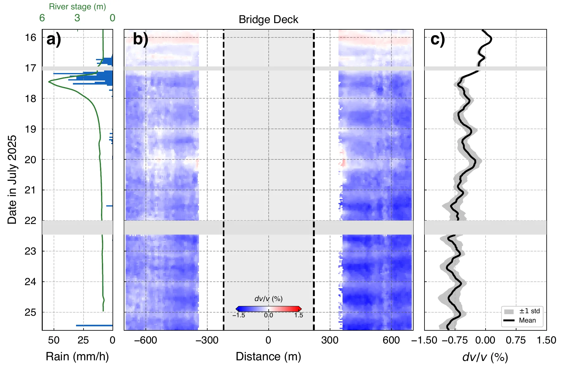
Left: rainfall and river level. Centre: change in seismic velocity along the corridor (blue = slower), with the bridge deck in grey. Right: the average change, falling after the storm. — Figure 8, Li et al. (2026), arXiv:2610.09289.
Seismic speeds in the riverbanks dropped as the storm arrived, stayed low during the rain, rebounded briefly during a weekend lull in traffic, then sank to a minimum during the river’s recession — up to 1.0% slower than before the storm. On one pair of sensors, the wave speed at 4.6 hertz, sensitive to about 50 metres down, fell from 730 to 678 metres per second. The authors read this as softening of waterlogged sediments: water reduces the grip between grains and adds weight. A slower part of the response lags by several days, possibly as rain soaks down through the soil, though the data cannot pin down the water table.
A cable already in place
The method has limits that the authors spell out. It is less sensitive to the top few metres, it depends on traffic, whose daily and weekly cycles leave their mark on the measurements, and it only reaches about 450 metres beyond the bridge. But the fibre records the bridge itself at the same time, which helps separate changes in the source from changes in the ground. The approach could be extended to railway viaducts, dams or wind turbines, and could one day help watch for scour around bridge foundations — using cables that are already buried along the road.