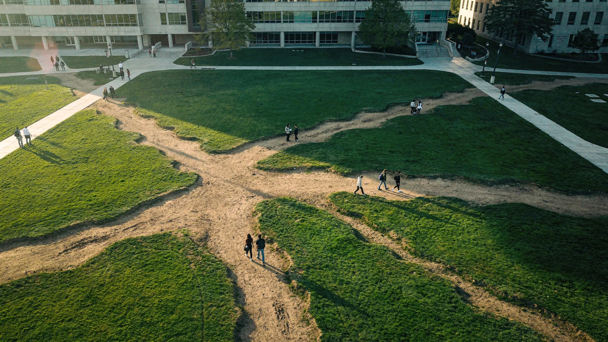
THE TRAILS THAT DRAW THEMSELVES
Step off the sidewalk to cut across the grass, and you leave a slight dent. The next walker finds that line a little easier, and so does the one after. Over time, the shortcut becomes a trail. Urban planners call it a desire path, a sign that the paved routes do not match where people want to go. In the 1960s, Michigan State University used this on purpose: it expanded its campus without laying new sidewalks, let students wear their own paths into the lawn, and only later paved them.
Animals do the same. Trails link the important places of their home ranges and follow seasonal migrations; grazing livestock carve them into hillsides; a single trail can be shared by many species. A trail system is a kind of memory stored in the landscape rather than in a brain: it summarizes countless journeys, across individuals, generations and even species, and any newcomer can use it right away.
Walkers who plan
Earlier models mostly had walkers drift towards what attracts them locally — trampled ground, or pheromones for ants. But many animals, humans included, know their surroundings and plan where they go. Brendan Wallace and Andrew Berdahl, at the University of Washington, built a model around that idea.
- Ten walkers move across a square world, each heading to a destination along the cheapest route it can compute.
- Every step lowers the cost of the ground underfoot, a little: a trail starts to form.
- Unused ground slowly returns to its original, costly state.
- Walking on fresh ground costs between 1 and 65 times as much as walking on trail, from a park lawn to snow or dense vegetation.
Trees, rings and crosses
What emerges depends on where walkers are going. Between fixed points, trails merge and split to link them all. Around a home base, they branch like a tree. Crossing from one side to the other, scattered straight tracks slowly fuse into a tree. With destinations scattered at random, a central ring or cross appears, with tendrils reaching out.
The extent of the network follows a simple balance: each step adds trail, and the existing trail fades at a steady rate. Together they set a trail budget, the most trail the walkers can keep alive. The easier trail forms and the slower it fades, the more sprawling the network.
An efficient trade-off
Connecting a set of points with the shortest possible network is a classic, notoriously hard problem: the Steiner tree, which the paper describes as NP-hard: no known method finds the best network quickly once there are many points. A planner must also trade off the amount of path built against how long journeys take.
The team ran 128 simulations with 32 destinations, varying how fast trail forms. Every resulting network fell on a single curve, an efficiency frontier: none could shorten journeys without more trail, or use less trail without longer journeys. No walker cares about the whole network, yet together they solve the trade-off efficiently. And running the same setup many times, with walkers starting from different spots, sometimes produced several distinct, stable networks — the outcome is not written in advance.
A 40-degree rule
When fresh ground is expensive, walkers stay on existing trails longer: unless the trail budget is very low, the network is leaner, and trails meet at angles closer to 90 degrees. The authors derive a critical angle — between a straight trail and the direct line to one’s goal — beyond which it pays to leave the trail and head straight for the goal; it depends only on the ratio between the cost of fresh ground and the cost of trail. In the simulations, the largest angles found in the networks rise in step with this prediction.
Apply it to people. Earlier observations found that pedestrians cut a new shortcut when the paved path is at least 30% longer. That is a cost ratio of 1.3, which gives a critical angle of about 40 degrees. Desire paths should therefore leave sidewalks at around 40 degrees, and appear wherever a sidewalk runs more than 40 degrees away from where people are heading.
Reading trails backwards
The model also changes how trails can be read. Several studies found fewer animal trails in open areas than in dense woods, and concluded that animals use open areas less. The model offers another explanation: costly terrain simply favours trails, because walkers gain more by reusing them. The angles of trails, in turn, could reveal how much effort animals spend moving.
The authors list the limits of their deliberately minimal model: walkers with perfect knowledge, uniform ground, a single species, no food to find. As drones and satellites map trail networks across habitats, they hope it will give that data a theory to be tested against — on campuses, in the wild and in cities alike.